

A cold front sweeping across the UK is set to bring significant disruptions due to snow and ice, with the Met Office issuing yellow weather warnings. These alerts, covering several regions, will come into effect from Sunday and extend into the week ahead.
Temperatures are expected to drop well below average for mid-November, with some particularly cold nights and frosty conditions. The arrival of snow could lead to travel challenges, especially in northern England, North Wales, and the Midlands, where it may cause disruption by Tuesday morning.
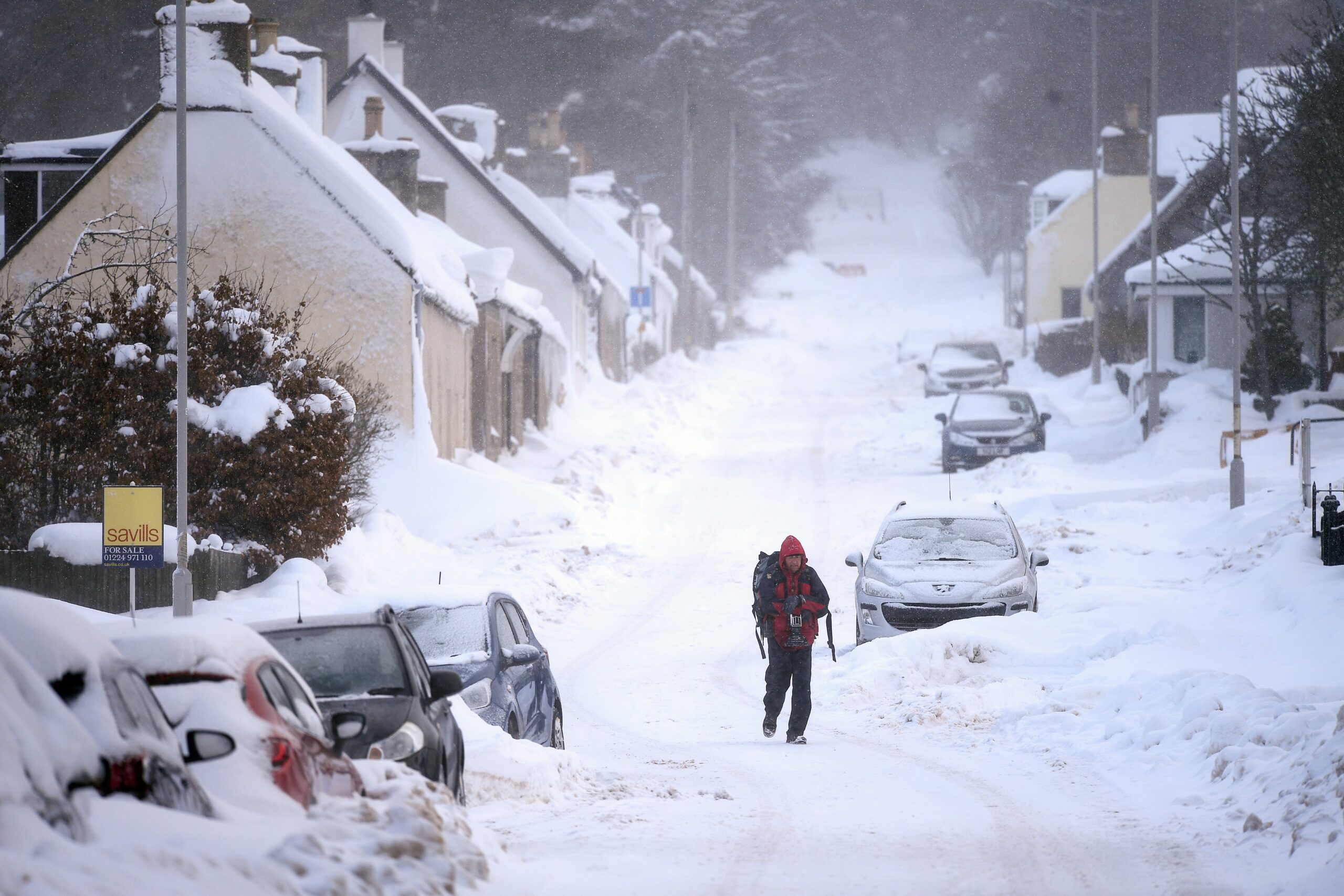
Northern Scotland will experience wintry showers on Sunday, with snow accumulating on high ground. The Met Office has issued a yellow warning for these areas, effective until Monday, with snowfalls of 5-10cm possible in the mountains, and up to 1-3cm at lower levels. Scotland and northern England will see a significant drop in temperature, with widespread frost anticipated, making Monday the coldest night of the autumn so far, with temperatures as low as -8°C in rural areas.
These cold and frosty nights will persist throughout the week, with daytime temperatures barely reaching 3-8°C. A strong northerly wind will exacerbate the chill, making it feel even colder.
The UK Health Security Agency has issued a cold health alert for the Midlands and northern England, warning of potential impacts on health and social care services. Vulnerable individuals could be at greater risk during this cold snap.
As the week progresses, a weather system moving northeast will bring heavy rain on Monday, which could turn into snow as it encounters colder air. The Met Office has warned that southern Scotland, northern England, North Wales, and the North Midlands could receive up to 20cm of snow on higher ground, with 2-10cm expected at lower levels. Icy conditions are likely to cause travel disruptions, particularly along higher trans-Pennine routes.
Though snow at lower levels in mid-November is uncommon due to relatively warmer ground temperatures, heavier snow is expected in some towns and cities, especially during the evening and overnight hours. The Midlands and eastern England could see sleet and snow moving southward by Tuesday morning.
While snow in November is rare, it is not unprecedented. Snowfall at higher altitudes in Scotland is typical for this time of year, but significant snow accumulation in England and Wales is less common. Historically, the last notable events of disruptive snow in November occurred in 1993 and 2010, when areas like northeast England and Scotland saw heavy snowfall, leading to a record-breaking cold December.
The cold spell is expected to last about a week, with bright, sunny days interspersed with wintry showers, particularly in Scotland and northern England. By the weekend, milder conditions from the southwest will bring wet and windy weather, though snow may briefly reappear before quickly melting.
BBC NEWS , ARY NEWS, REUTERS, GUARDIAN, EXPRESS NEWS